Caring for our rivers and land - by community for community
Caring for our rivers and land - by community for community
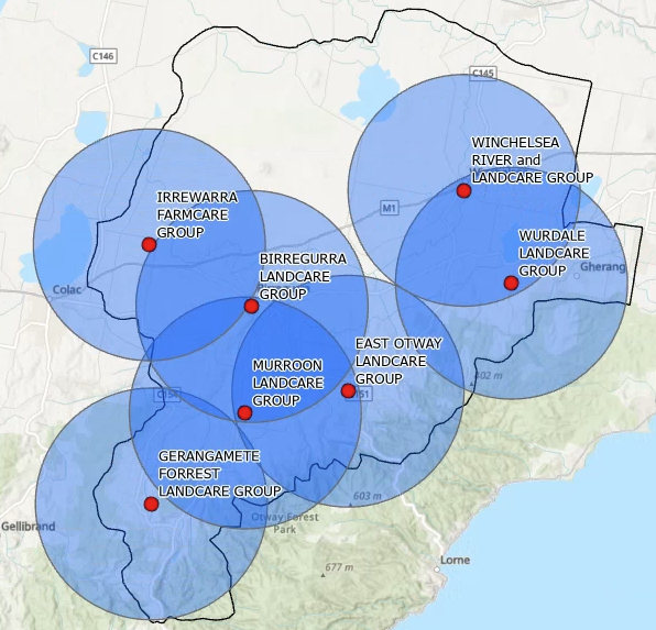
MAP
NETWORK AREA
The Upper Barwon Landcare Network supports an area of more than 153,000 hectares in the mid and upper Barwon River catchments that occur upstream of Inverleigh into the northern foothills of the Otway Ranges. The network area covers major sections of both the Surf Coast Shire and Colac Otway Shire. The catchment varies in topography, soil type and vegetation and supports a diversity of rural activities and lifestyles. Farm enterprises include dairying, beef & sheep grazing, broad-acre cropping, intensive pig and poultry farming as well as potato and pasture seed production with several organic seasonal vegetable production farms and small scale market gardens emerging. Agroforestry is also well integrated on many properties that provides a “biological infrastructure’ for sustainable robust and resilient farms.
OUR GROUPS
The Upper Barwon Landcare Network is an independent organisation in it’s own right, delivering regional projects on private and public land. It also provides support to a number of community groups that are based within the region in the area’s of funding, governance, auspice, project development and event coordination. A list of the groups the UBLN supports is listed below. If you have a community central agricultural or environmental project idea you would like to get off the ground please get in touch to see if it is something the network can support you in or direct you to the appropriate existing community group.